

Sie folgen nun
Fehler beim Folgen des Nutzers.
Dieser Nutzer erlaubt es nicht, dass andere Nutzer ihm folgen.
Sie folgen diesem Nutzer bereits.
Ihr Mitgliedschaftsplan bietet nur 0 Folgen an. Upgraden Sie hier.
Erfolgreich entfolgt
Fehler beim Nichtfolgen des Nutzers.
Sie haben erfolgreich empfohlen
Fehler beim Empfehlen des Nutzers
Ein Fehler ist aufgetreten. Bitte aktualisieren Sie die Seite und versuchen Sie es erneut.
E-Mail erfolgreich bestätigt.

caito,
egypt
Es ist derzeit 8:26 AM hier
Beigetreten am Juli 21, 2016
0
Empfehlungen
Sayyed F.
@sidfarag
0,0
0,0
0%
0%
caito,
egypt
N/A
Abgeschlossene Arbeiten
N/A
Budgetgerecht
N/A
Pünktlich
N/A
Wiedereinstellungsrate
GIS Professional / ArcGIS specialist
Kontaktieren Sie Sayyed F. bezüglich Ihres Jobs
Melden Sie sich an, um Details im Chat zu besprechen.
Portfolio
Portfolio
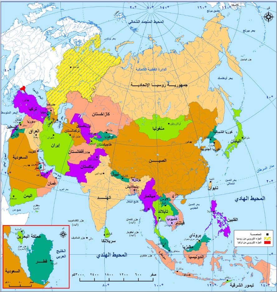

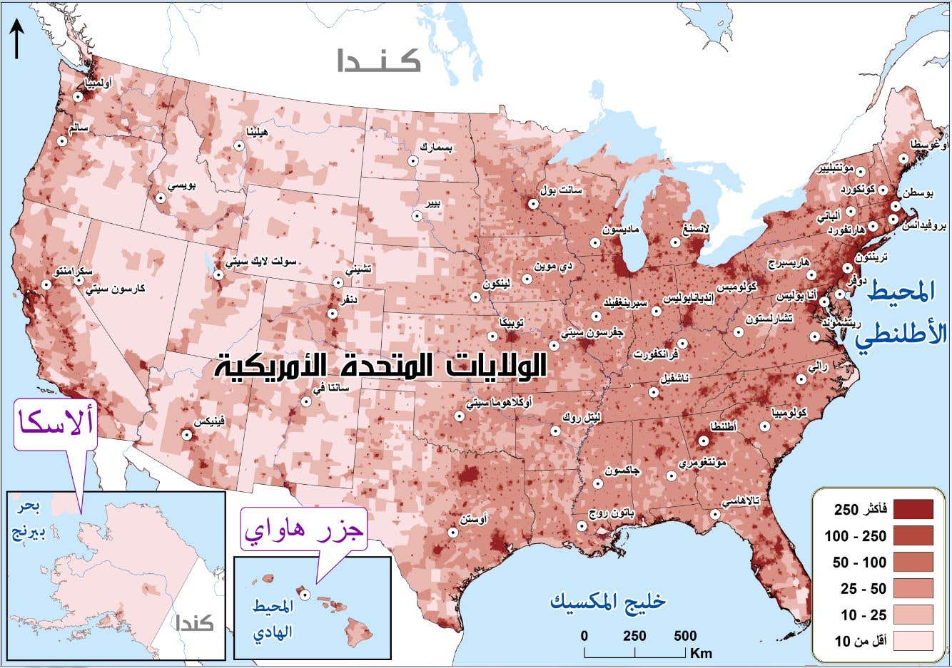
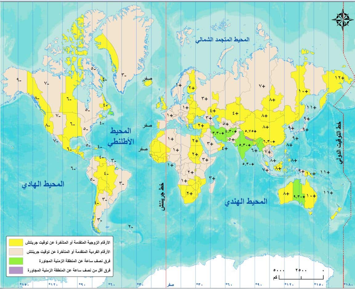
Atlas of Oman

Atlas of Oman

Atlas of Oman

Atlas of Oman

Atlas of Oman

Atlas of Oman

Atlas of Oman

Atlas of Oman

Atlas of Oman

Atlas of Oman
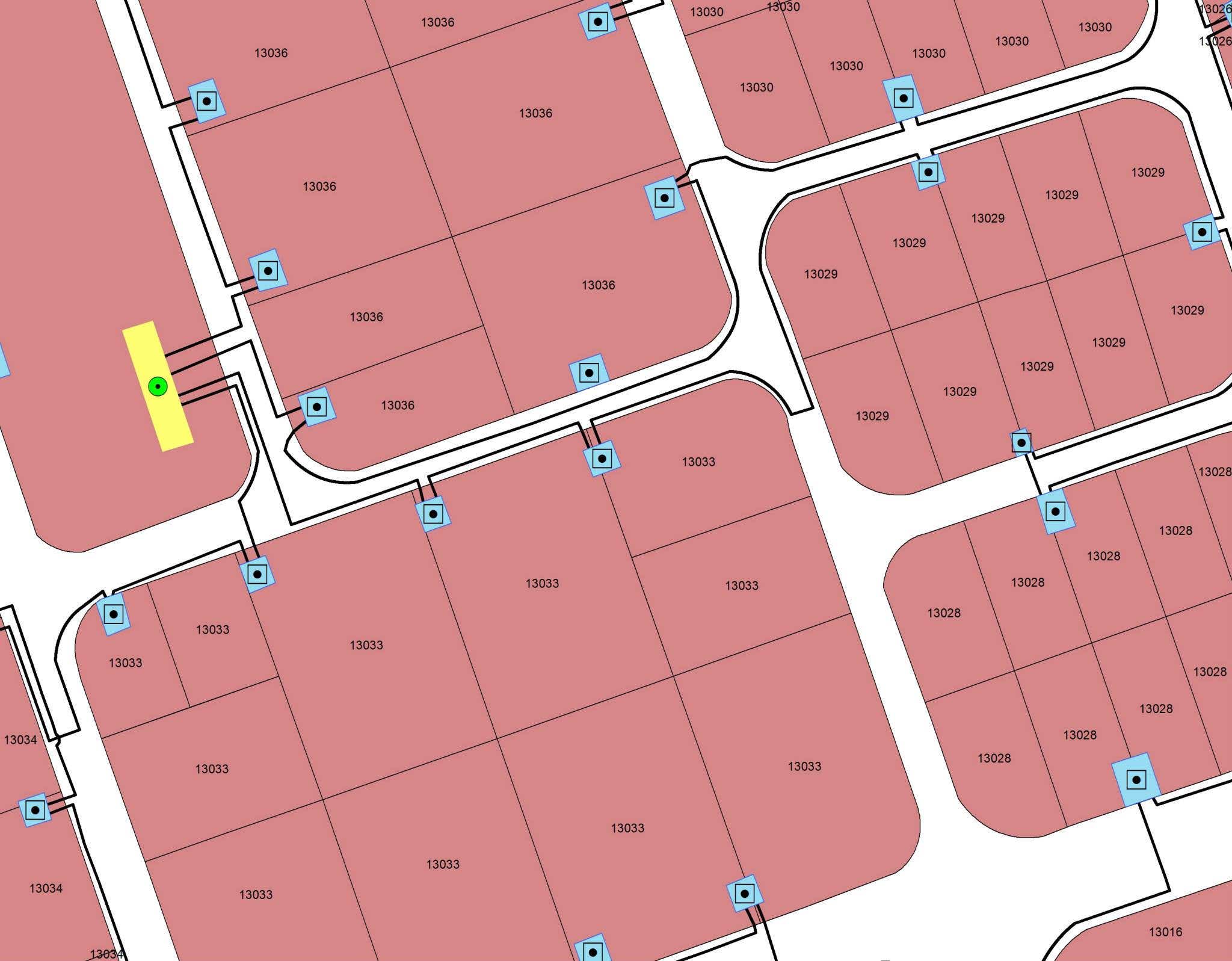

Aubour electric power for Industrial area

Aubour electric power for Industrial area

Social studies books for Dubai schools

Saudi Arabia Social studies external book
Atlas of Oman
Atlas of Oman
Atlas of Oman
Atlas of Oman
Atlas of Oman
Atlas of Oman
Atlas of Oman
Atlas of Oman
Atlas of Oman
Atlas of Oman
Aubour electric power for Industrial area
Aubour electric power for Industrial area
Social studies books for Dubai schools
Saudi Arabia Social studies external book
Bewertungen
Änderungen gespeichert
Hier keine Bewertungen zu sehen!
Erfahrung
Cartographer - GIS Specialist
Feb. 2014 - Aktuell
GIS Mapping Technician and Cartographer
Surveyor
Sept. 2013 - Feb. 2014 (5 Monate, 1 Tag)
Data Mining for Egyptian Census 2016
GIS Specialist
Mai 2012 - Feb. 2014 (1 Jahr, 9 Monate)
Freelancer GIS projects
Ausbildung
Bachelor - Good / Geography "Geographic Information Systems" GIS
(3 Jahre)
Qualifikationen
Basics of JavaScript Web Apps
ESRI
2017
Building GIS web Applications by ArcGIS API for JavaScript
AutoCAD Course
Ain Shams University
2007
AutoCAD Course
GIS and Reomote Sensing Training
NARSS
2009
GIS and Reomote Sensing Training
Veröffentlichungen
Social Studies books for Qatar
Kalemon
Social Studies books for Qatar
Kontaktieren Sie Sayyed F. bezüglich Ihres Jobs
Melden Sie sich an, um Details im Chat zu besprechen.
Verifizierungen
Top-Fähigkeiten
Ähnliche Freelancer anschauen
Ähnliche Vorzeigeprojekte ansehen
Einladung erfolgreich zugesendet!
Danke! Wir haben Ihnen per E-Mail einen Link geschickt, über den Sie Ihr kostenloses Guthaben anfordern können.
Beim Senden Ihrer E-Mail ist ein Fehler aufgetreten. Bitte versuchen Sie es erneut.
Das Kopieren in der Zwischenablage ist fehlergeschlagen, bitte nach Anpassung Ihrer Berechtigungen erneut versuchen.
In der Zwischenablage kopiert.
Vorschau wird geladen
Erlaubnis zur Geolokalisierung erteilt.
Ihre Anmeldesitzung ist abgelaufen und Sie wurden abgemeldet. Bitte melden Sie sich erneut an.